
The Wives of Rufus J. Langdon (Elder)
1st Wife (Mary) •••••••••••••••••••••••••••••••••
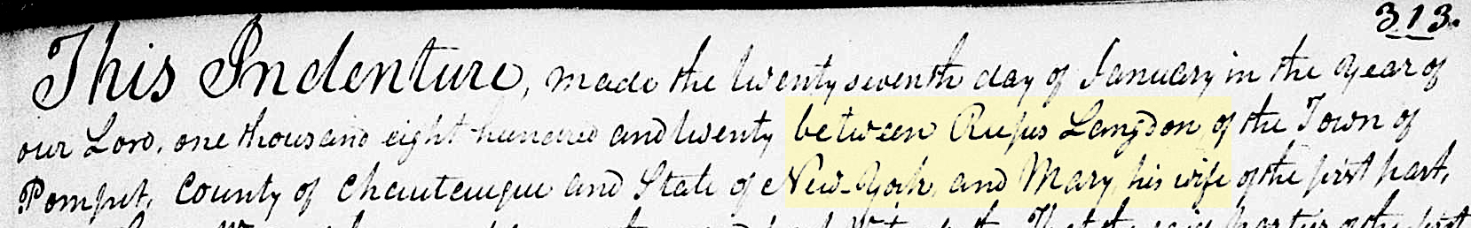
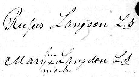
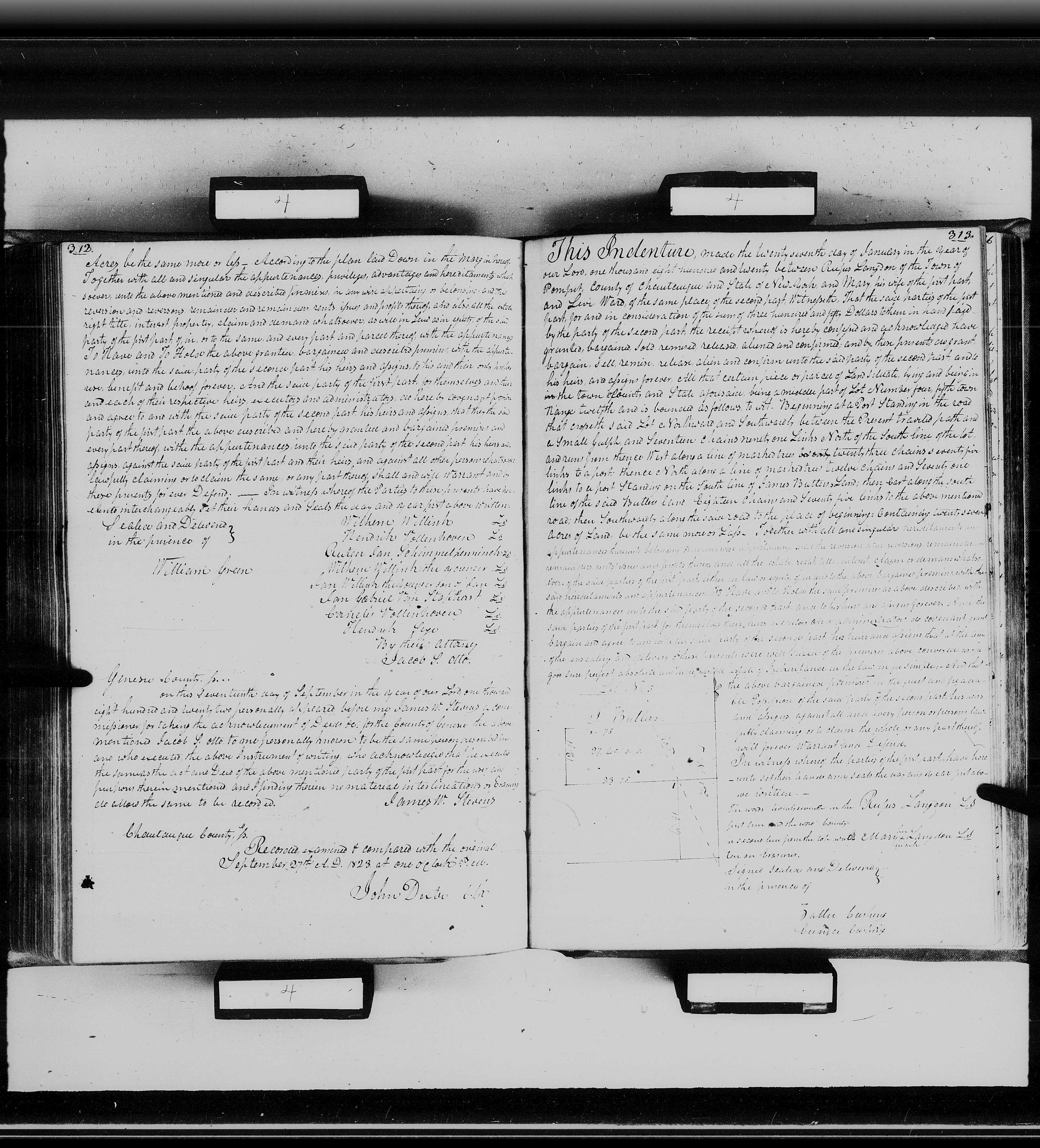
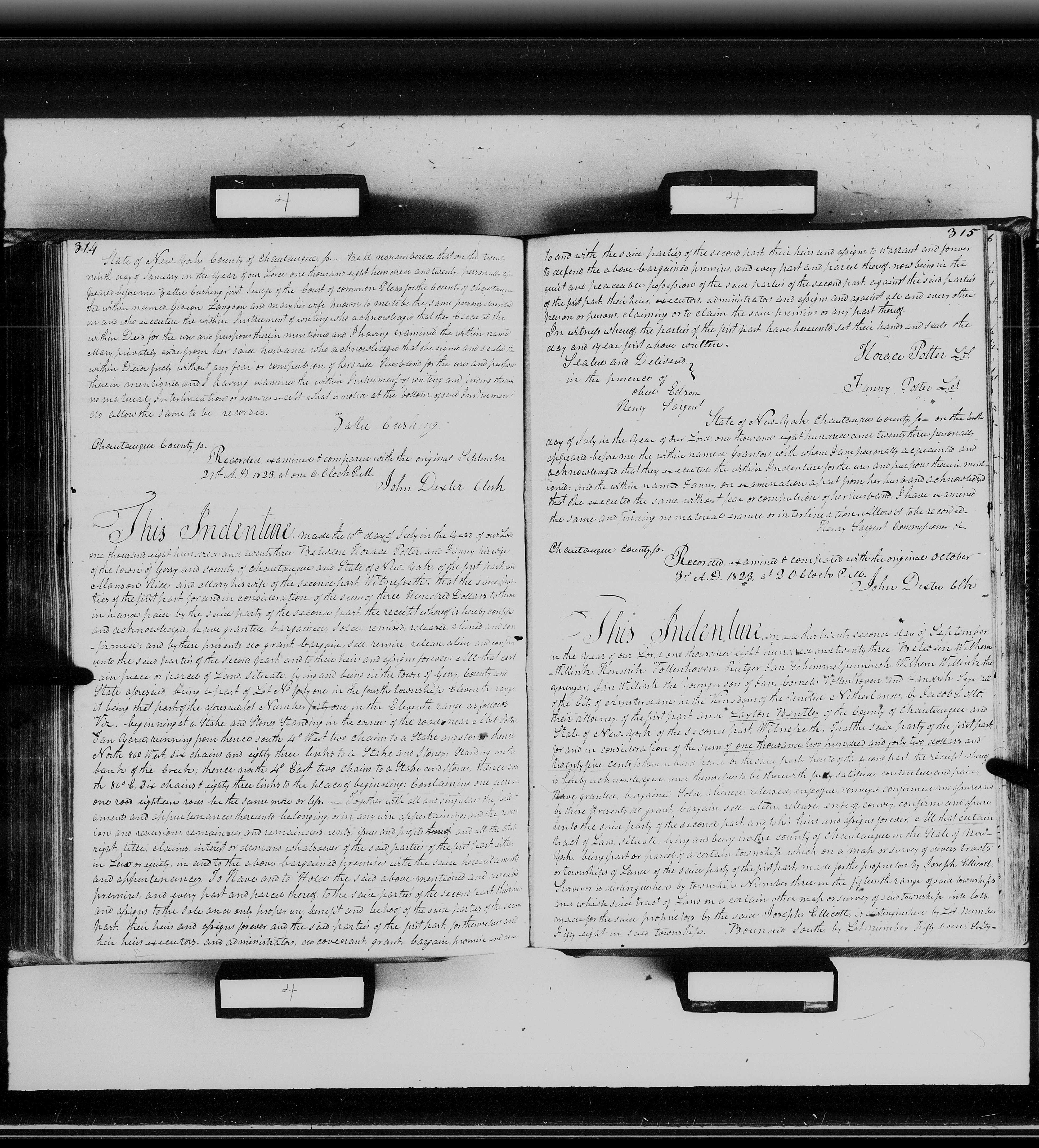
1820 he sells land in New York. The document names Rufus (Elder) and his wife Mary. It also names “Gideon Langdon and Mary his wife”.
LINK to 1st page
LINK to second page.
Click Image for a larger view
2nd Wife (Sarah) ••••••••••••••••••••••••••••••
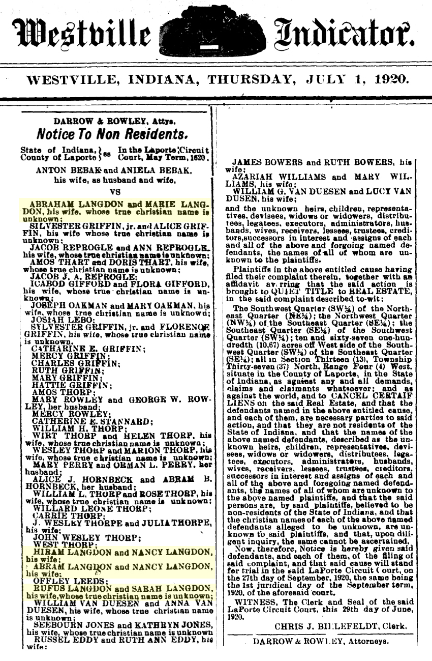
Interesting lawsuit from July 1920 in LaPorte County, Indiana that names many of our Langdons. The lawsuit is a “Quiet Title to Real Estate”. It’s a lawsuit that’s filed when there are questions about who has claims to the title. It quiets all future claims against the property.
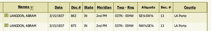
Where did they get these names? Gideon’s brother Abraham (Abram) owned part of the land described in the lawsuit. It’s listed in the Government’s Land Bureau records. His brother Hiram owned land not far away in Porter county. Rufus Elder livied with Hiram for several years. In 1830 they lived in Clark County, Ohio. Gideon married his thrid wife there. Abraham’s wife in this lawsuit is listed as Marie.
Speculation:
Could she be the Maria that lived next to Rufus younger? Need to look at records from the area and find out how everyone is involved. It seems like the family was grouped in this area for awhile before moving to Wisconsin.
Where is Rufus (Elder) Buried? ••••••••••••
Click Image for a larger view in new website
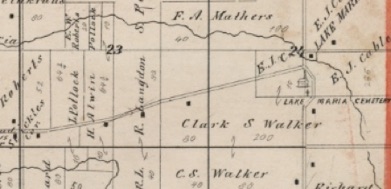
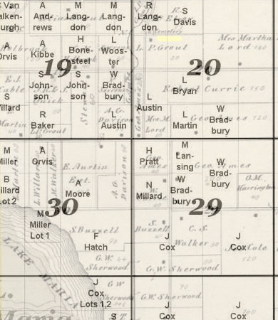
Rufus (Younger) bought and sold roughly 20 pieces of land during his lifetime. The land Rufus and Catherine were living on in 1875 is visible in the map above. Catherine’s parents are buried in the Stickles Cemetery to the left. It’s now named Williams Cemetery.
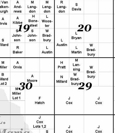
Rufus was living on the land shown at left in the 1840s-1850s. It shows the deeds of the earliest settlers in the area and was put together by the Green Lake County Local History Web.
It looks like he sold part of the land in 1850. On 31 Mar, 1855 he sold it outright with the following exceptions:
Date: 31 Mar, 1855
Description of Property: NW l/4 of NW l/4 Sec. 20 TWN 14N R 13E
• except a piece of land deeded to Lewis Wooster on 8 July 1850 and recorded in Bk II, of Deeds, p 449 and 451, 31 Mar, 1855.
• except a certain lease given to School Dist. No. 4 as long as used for burial purposes.
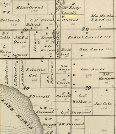
If you overlay the above map with the 1875 plat map of the area, there's a cemetery shown on the land Rufus Jr. owned when he first settled in the area.
••••••••••••••••••••••••••••••••••••••••••••••••••••••
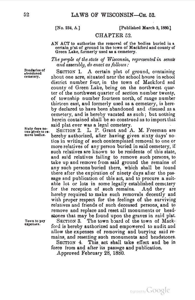
Wisconsin session laws, Volume 1880
Office of the Secretary of State
CHAPTER 52.
[No. 234, A.] [Published March 2,1880]
AN ACT to authorize the removal of the bodies buried in a certain plat of ground in the town of Mackford and county of Green Lake, formerly used as a cemetery. The people of the state of Wisconsin, represented in senate and assembly, do enact as follows:
SECTION 1. A certain plat of ground, containing about one acre,
situated near the school house in school district number four, in the
town of Mackford and county of Green Lake, being on the northwest quarter of the northwest quarter of section number twenty, of township number fourteen north, of range number thirteen east, and formerly used as a cemetery, is hereby declared to have been abandoned and disused as a cemetery, and is hereby vacated as such; but nothing herein contained shall be so construed as to import that said plat ever was a legal cemetery.
SECTION 2. L. P. Grant and A. M. Freeman are hereby authorized, after having given sixty days notice in writing of such contemplated removal to one or more relatives of any person buried in said cemetery, if such relatives are known to be residents of this state, and said relatives failing to remove such persons, to take up and remove from said ground the remains of any such persons buried there, which shall be found there after the expiration of ninety days after the passage and publication of this act, and to procure a suitable lot or lots in some legally established cemetery for the reception of such remains. And they are hereby required to make such removals decently and with proper respect for the feelings of the surviving relatives and friends of such deceased persons, and to remove and replace and reset all monuments or headstones that may be found upon the graves in said plat.
SECTION 3. The town board of the town of Mackford is hereby authorized and empowered to audit and allow the expenses of removing and burying said remains, and resetting such monuments and headstones.
SECTION 4. This, act shall take effect and be in force from and after its passage and publication.
Approved February 28, 1880.
••••••••••••••••••••••••••••••••••••••••••••••••••••
Rufus (Elder) Land in New York
Rufus bought land on Lake Erie in western New York in 1806 from the Holland Company.

LINK • BOOK
“Pioneer history of the Holland Purchase of western New York”. Search for “Rufus Langdon”. He bought the following section of land:
(T. 6, R. 12) meaning: Township 6, Range 12
LINK • 4 PROPERTY MAPS
Here's 4 maps of his land.
Who is the Holland Company?
LINK • Article about The Holland Company
1805 Rufus (Elder) & Seth Cole
Gideon’s father Rufus (Elder) Langdon took an article with the Holland Land Co. on 7 June 1805 for the South 1/3 of Lot 15-6-12. By 1807 it had reverted, was transferred to Rufus Scott in 1809, transferred to George Pierce in 1810. In effect Rufus Langdon traded Lot 15 for the South ½ of Lot 4, Twp.5, Range 12, well down in Pomfret. By 1812 He and Gideon were both on Lot 4 while the Widow Cole was well up on the Lake shore on Lot 28.
(Thanks to Douglas Shepard)
LINK to the original purchases of lots and parts of lots within the present town limits of Dunkirk.
Fredonia and the War of 1812 • Canadaway Creek
June 10, 2012
By DOUGLAS H. SHEPARD
The Mrs. Cole in the article was once Rufus and Gideon’s neighbor.
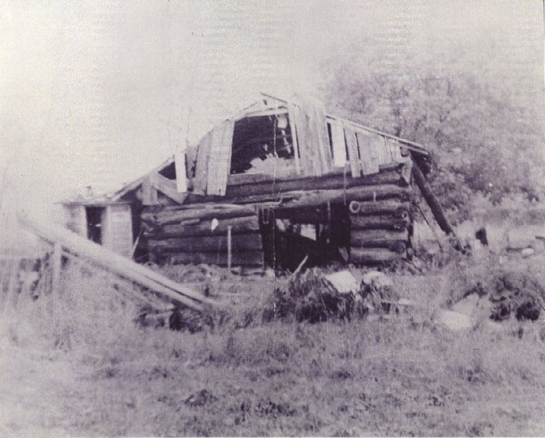
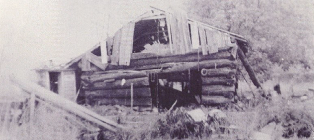
Click Image for a larger view
LINK • He served in John McMahan’s regiment in the War of 1812 with Gideon. The photo was taken in 1915. Rufus’ cabin was probably very similar.
••••••••••••••••••••••••••••••••••••••••••••••••••••
Rufus (Elder) Census Records
LINK 1800 FEDERAL CENSUS
Town of Paris, NY
LINK 1810 FEDERAL CENSUS
Town of Pomfret, Chautauqua County, NY
LINK 1811 ASSESSMENT ROLLS
Town of Pomfret, Chautauqua County, NY
Langden, Rufus/5/12/south part lot 4
LINK 1820 FEDERAL CENSUS
Town of Pomfret, Chautauqua County, NY
Langdon, Rufus............Pomfret.......107
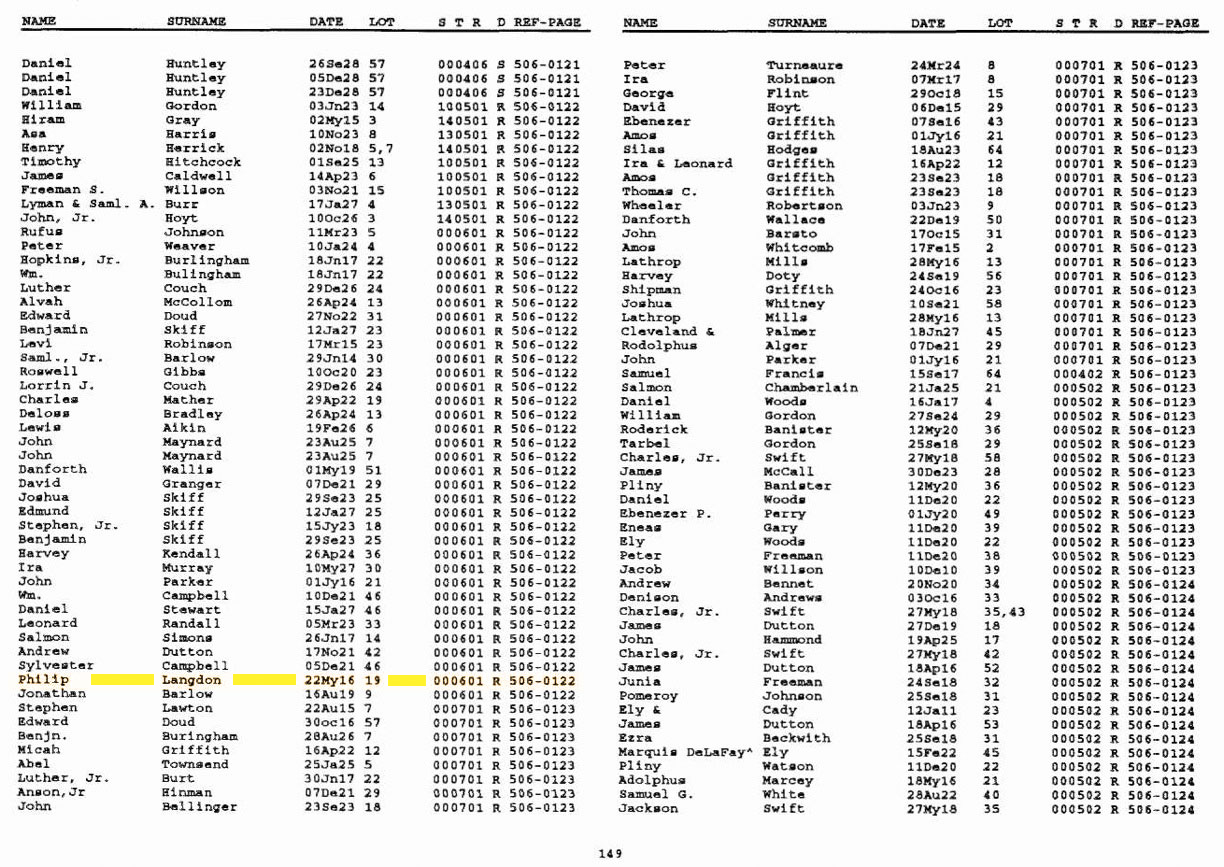
Rufus (Elder) and Abram G. Langdon in Columbia County 1848 Town of Randolph
LINK • The history of Columbia County, Wisconsin
This is the Elder Rufus and Abraham G. Langdon. Columbia county is just below Green Lake County. The text shows the first town officers elected and provides a list of who voted at the first general election.
Rufus (Elder) church records
Sherry Cyza sent a great link to the Fredonia Baptist Church Archives in Fredonia, Chautauqua County, NY. “Rufus Langdon” and his wife “Sister Langdon” and in here. (Record Book A and List of Members)
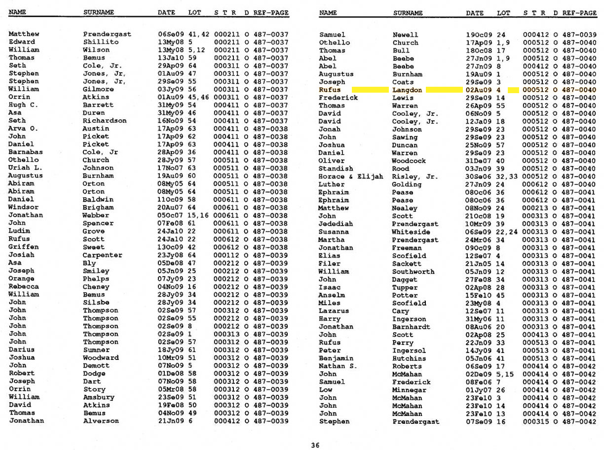
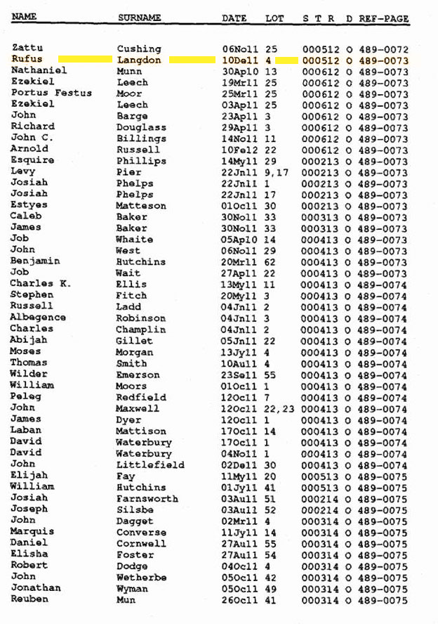
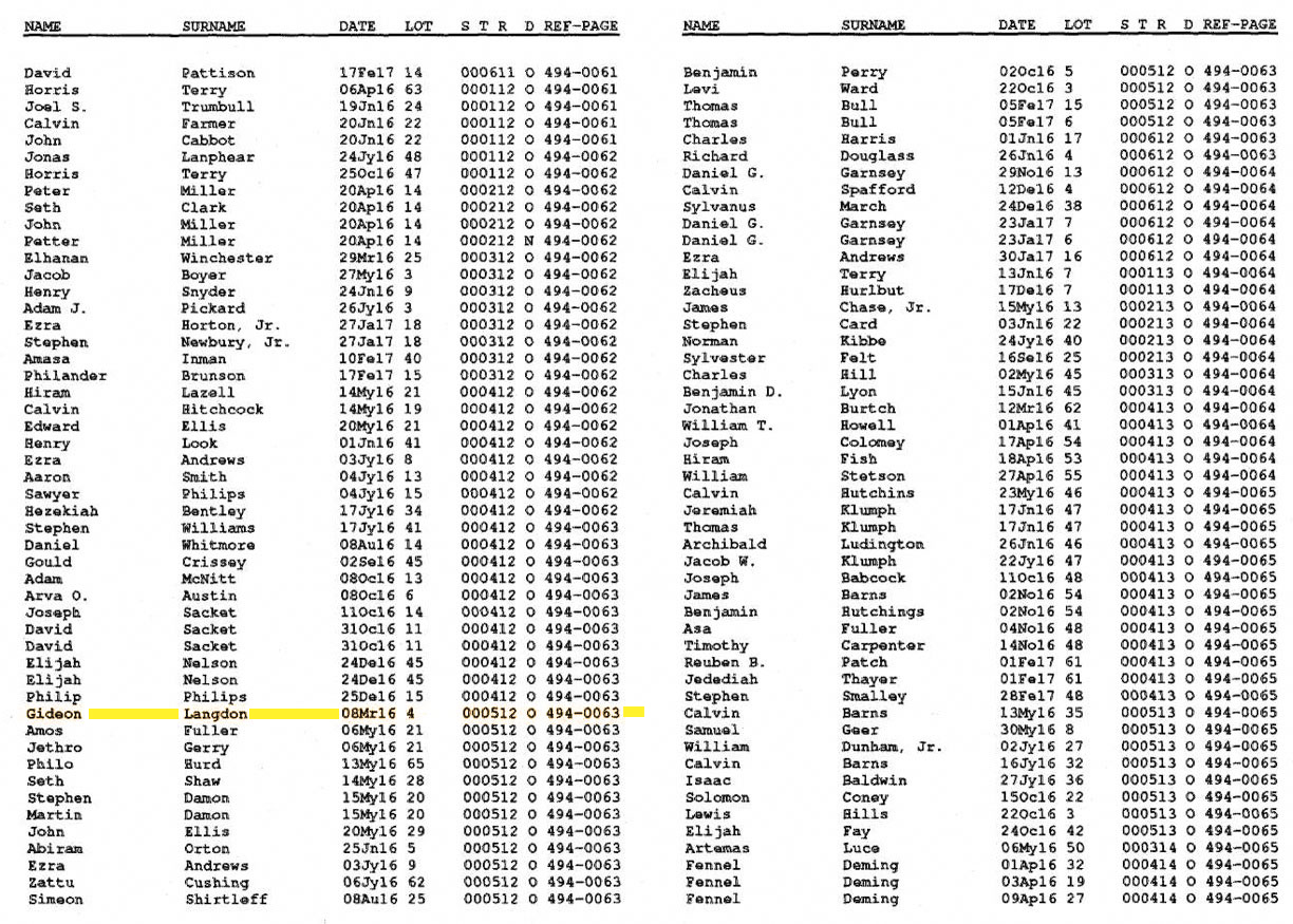
Holland Co. Land Records
I’ve been meaning to add these. I wanted to start another page, but I’m not sure when that will happen. In the meantime here they are.
LINK 1809 Rufus Land
LINK 1810 Rufus Land
LINK 1816 Gideon Land
LINK 1816 Phillip Langdon Land
Don’t know if he’s related.
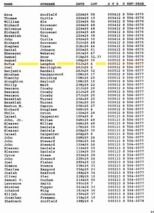
LINK 1826 Rufus Land
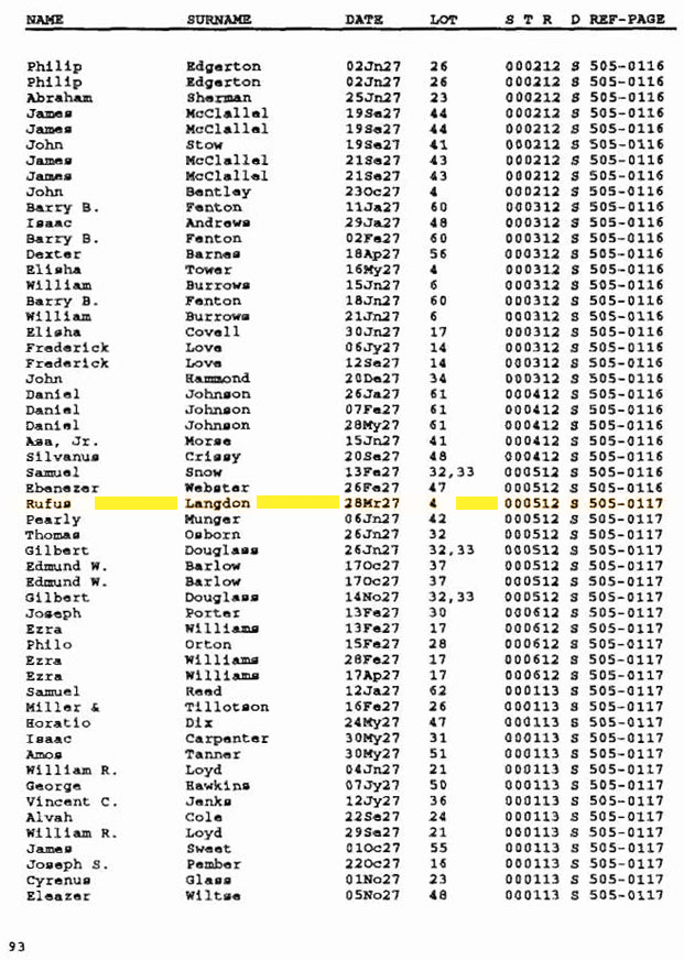
LINK 1827 Rufus Land

